
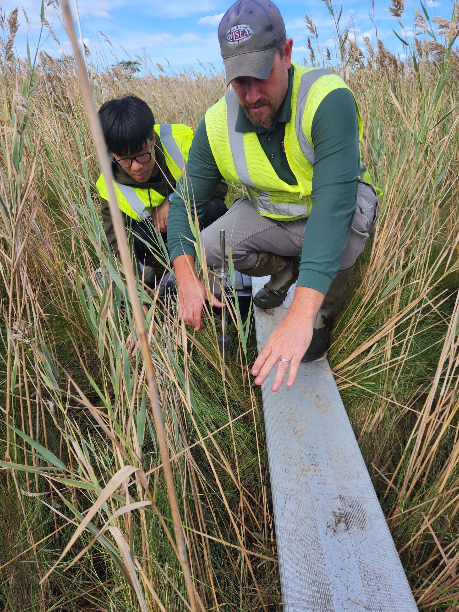
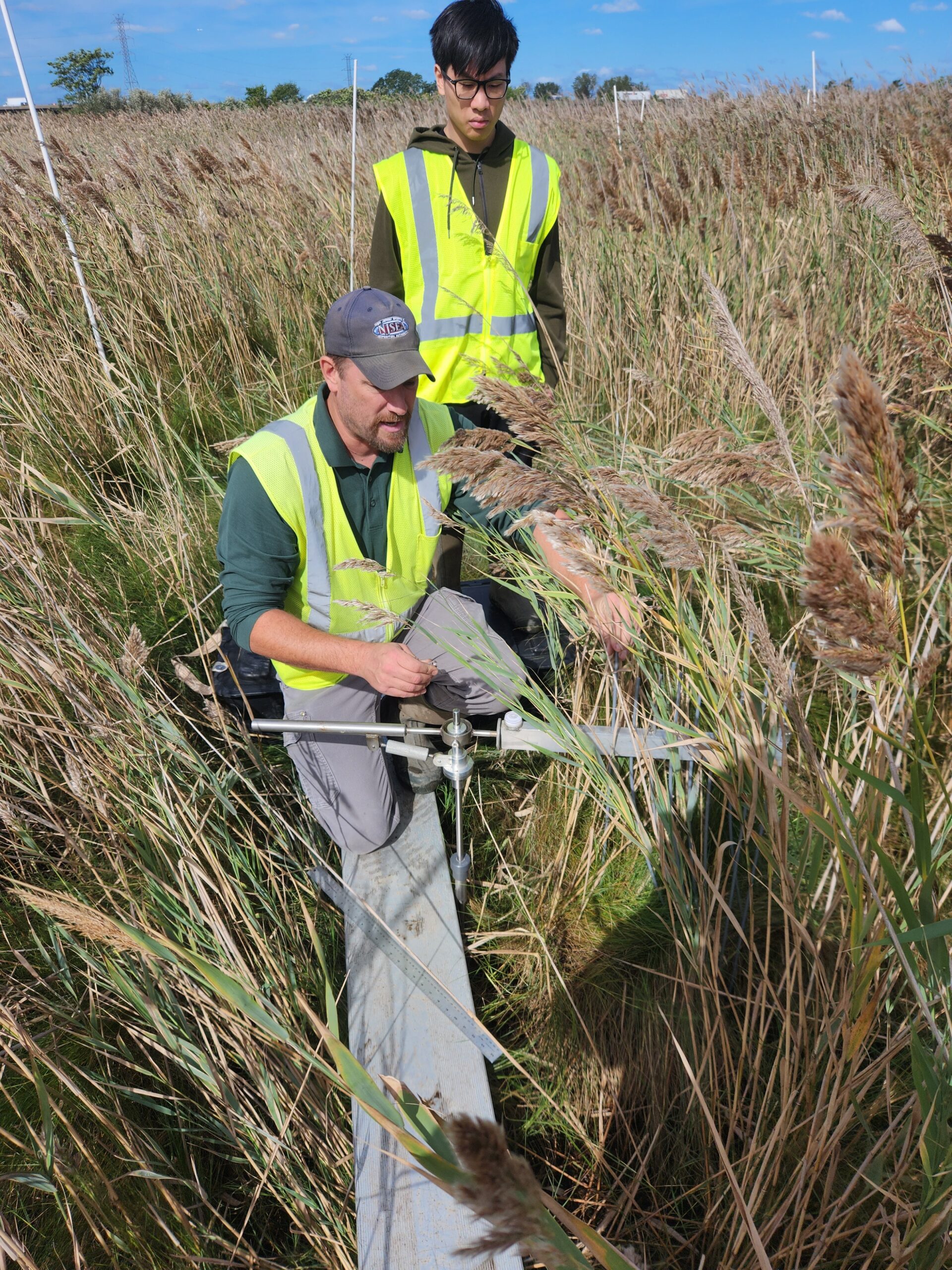
L – MRRI Senior Environmental Scientist Joe Grzyb steadies himself on an aluminum plank as intern Reece Sit looks on. R – Joe prepares to take Surface Elevation Table Measurements
Joe Grzyb, an NJSEA Meadowlands Research and Restoration Institute (MRRI) Senior Environmental Scientist, was conducting Surface Elevation Table (SET) measurements at the Riverside Marsh in Lyndhurst with help from the department’s interns. Each September and continuing through mid-December, Joe and the year’s interns use a rod surface-elevation table instrument to determine how wetlands in the Meadowlands District keep pace with sea level rise. MRRI began tracking sediment elevation in 2008.
Joe steadied his footing on an aluminum plank as reeds whipped around him on a blustery, late September morning. Reece Sit helped assemble the SET instrument. Joe carefully but firmly inserted pins from a metal measuring device into a pipe receiver protruding from the marsh surface and called out measurements in millimeters. Lily Day recorded the numbers in a small, yellow field book, repeating the figures for accuracy.
The receiver is a vital element of long-term marsh elevation monitoring, serving as an unchanging reference elevation. This receiver is meticulously anchored at a depth of 20 feet or more within the ancient clay deposits of the former Lake Hackensack, a geological formation stemming from the last glacial period. This deep, stable anchoring keeps the receiver’s elevation constant, providing an unvarying baseline for comparative measurements over time.
Into The Marsh

The SET monitoring program is critical. Marshes have many significant environmental benefits that would be lost if they were inundated by rising water levels. They provide protection from storms by acting like large sponges that absorb rainwater. Wetlands also trap pollutants, prevent erosion and provide wildlife habitat, to name just a few additional benefits.
Joe said that large storms and runoff from urban areas in the Meadowlands add more sediment to the marsh system, which helps build up the wetlands. The measurements at Lyndhurst Riverside showed surface elevation had increased by 4.59 millimeters over the past year. Analysis of current elevation data indicates a varied response across Lyndhurst Riverside. While some areas are exhibiting elevations that exceed the rate of sea-level rise, others are not. This mixed response suggests that, so far, the overall elevations are keeping pace with sea-level rise.

Riverside is one of nine Meadowlands marshes where MRRI carries out SET measurements. Readings are taken at 108 points within each marsh. The vegetation at some sites is so dense that Joe, Lily and Reece make preliminary visits to stomp out and clear paths to data collection spots. They gather information at one marsh per week, spending approximately two hours on the project. Joe then inputs the data into spreadsheets for analysis.
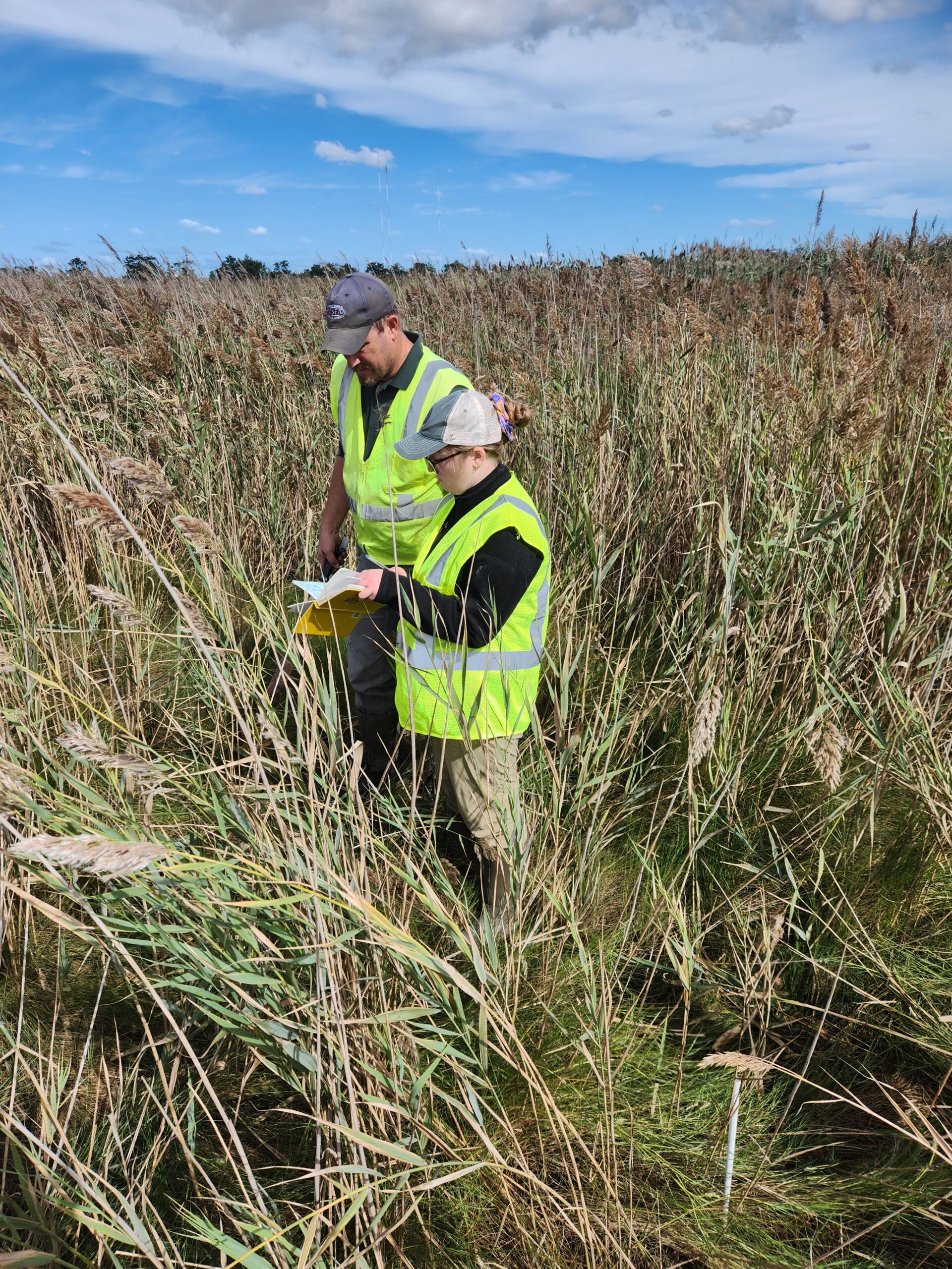
Joe confers with Lily
Information gathered at other sites last month, including two in Secaucus, showed wetlands elevations increasing by more than 5 millimeters. According to NOAA and the New Jersey Department of Environmental Protection, the current observed rate of sea-level rise in northern New Jersey is approximately 4 millimeters to 5 millimeters per year.
A final report mapping all sites will be submitted to the New Jersey Tidal Wetland Monitoring Network in January.
Joe said that, overall, Meadowlands District marsh elevations are in a good position to track with sea level rise.